

Roopkund Trek: The Mystery Lake Adventure in Uttarakhand
Explore Tours
About the Tour
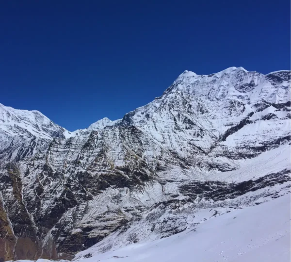
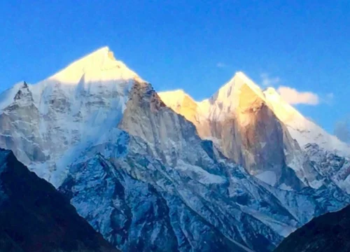
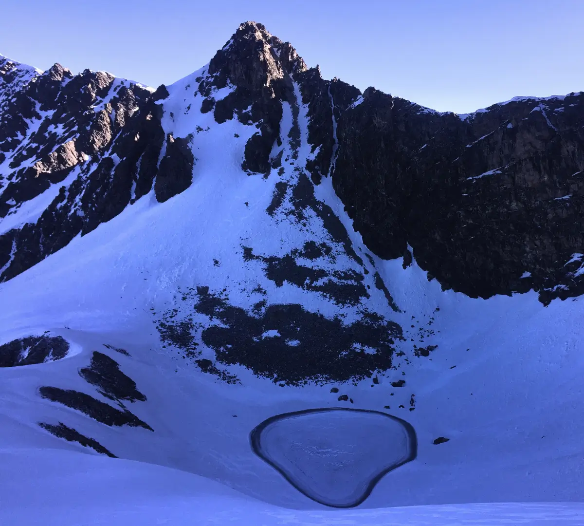
The Roopkund Trek, also known as the “Mystery Lake Trek,” is one of India’s most thrilling high-altitude adventures. Located at 5,029 meters in the Chamoli district of Uttarakhand, Roopkund is famous for its stunning glacial lake filled with human skeletons, believed to date back over 1,000 years. The trek offers mesmerizing views of the Trishul and Nanda Ghunti peaks, making it a must-do for thrill-seekers and nature lovers.
Tour Details
- Region: Uttarakhand
- Altitude: 5,029 meters (16,499 feet)
- Duration: 7-9 Days
- Trek Distance: 53 km
- Difficulty Level: Moderate to Difficult
- Best Time to Visit: May to June & September to October
- Temperature: Day: 5°C to 15°C | Night: -5°C to -2°C
- Start Point: Lohajung
- End Point: Lohajung
Tour Challenges
- High-altitude trekking with steep ascents.
- Low oxygen levels beyond 4,000m.
- Harsh weather conditions at the glacier.
- Unpredictable snowfall and icy terrain.
Tour Facilities
- Experienced trek leaders and guides.
- Quality camping equipment and sleeping bags.
- Vegetarian meals throughout the trek.
- Medical assistance with oxygen cylinders.
Food
- Nutritious vegetarian meals.
- Breakfast: Tea, porridge, eggs, toast.
- Lunch: Dal, rice, roti, vegetables.
- Dinner: Soup, main course, dessert.
Who Can Participate?
- Trekkers with moderate to advanced trekking experience.
- Age limit: 15 years and above.
- Good physical fitness is required.
How to Reach Lohajung?
Meeting Point: Kathgodam
Nearest Airport:
Pantnagar Airport, 250 km from Lohajung.
Nearest Railway Station:
Kathgodam Railway Station, 225 km from Lohajung.
By Road:
Lohajung is accessible via road from Kathgodam, Rishikesh, and Dehradun.
Pick-Up and Drop-Off Information
- Pick-Up Point: Kathgodam
- Drop-Off Point: Kathgodam
Latitude and Longitude
- Latitude: 30.2606° N
- Longitude: 79.7310° E
Key Highlights
- Visit the mysterious skeleton lake at Roopkund.
- Trek through the lush green meadows of Ali & Bedni Bugyal.
- Enjoy breathtaking views of Mt. Trishul and Nanda Ghunti.
- Experience an exciting high-altitude glacier trek.
Join the Roopkund Trek and explore one of India’s most mysterious and breathtaking trails!
Included/Exclude
Inclusions in the Tour Package
- Accommodation: Camps (Sharing Camp for two people), Home Stay.
- Guides & Support Staff: Qualified & experienced Trek Leader, Guide, and Support staff to assist trekkers.
- Sleeping Gear: Sleeping Bags.
- Meals: All meals during the trek (Breakfast, Packed Lunch, and Dinner – only vegetarian).
- Permits & Fees: Trekking Permits and Forest Fees.
- Trekking Equipment: Tent, Mattress, Sleeping Bag, Dining & Kitchen Tent, Toilet Tent, Cooking Utensils, and Crampons (if required).
- Medical Assistance: First aid medical kits and oxygen cylinder.
- Guide & Support Staff Expenses: Guide Allowances, Food, and Stay.
- Potters: Potters will carry only trekking equipment.
- Potter's Expenses: Allowances, Food, and Stay.
- Kitchen Staff: Included for cooking and meal preparation.
- Kitchen Staff Expenses: Allowances, Food, and Stay.
- Cook: Responsible for preparing meals.
- Cook's Expenses: Allowances, Food, and Stay.
- Transportation: As per the trek itinerary.
Exclusions in the Tour Package
- Any other facilities that are not mentioned in the inclusions.
- Potters for carrying your personal luggage.
- Extra meals like lunch during the journey by cab and stay at hotels (lunch is only provided during the trek).
- Personal expenses such as Water Bottles, Laundry, Phone Calls, etc.
- Insurance.
- Gaiters.
- Anything not specifically mentioned under "Inclusions."
Tour Amenities
Certified Trek Leader
Hassle-Free Permits
Warm Meals, Always
Itinerary
Overview
Drive Distance: 210 km (approx. 10 hours)
Starting Altitude: 554 meters / 1,817 feet at Kathgodam
Ending Altitude: 2,320 meters / 7,610 feet at Lohajung
Detailed Plan
- Depart from Kathgodam early morning, driving through picturesque towns like Bhimtal, Almora, and Kausani.
- Enjoy views of the Kumaon region's lush landscapes and terraced fields.
- Arrive at Lohajung by evening; this village serves as the base camp for the trek.
- Overnight stay in a guesthouse or lodge.
Overview
Trek Distance: 6.5 km (approx. 5-6 hours)
Starting Altitude: 2,320 meters / 7,610 feet at Lohajung
Ending Altitude: 2,600 meters / 8,530 feet at Didna Village
Detailed Plan
- Begin the trek descending towards the Neel Ganga River, crossing it via a sturdy bridge.
- Ascend through dense oak and rhododendron forests, keeping an eye out for local wildlife.
- Reach Didna Village by afternoon; this quaint village offers insights into local Himalayan life.
- Overnight stay in a homestay or tents.
Overview
Trek Distance: 10.5 km (approx. 6-7 hours)
Starting Altitude: 2,600 meters / 8,530 feet at Didna Village
Ending Altitude: 3,400 meters / 11,154 feet at Ali Bugyal
Detailed Plan
- Trek through dense forests leading to the alpine meadows of Ali Bugyal.
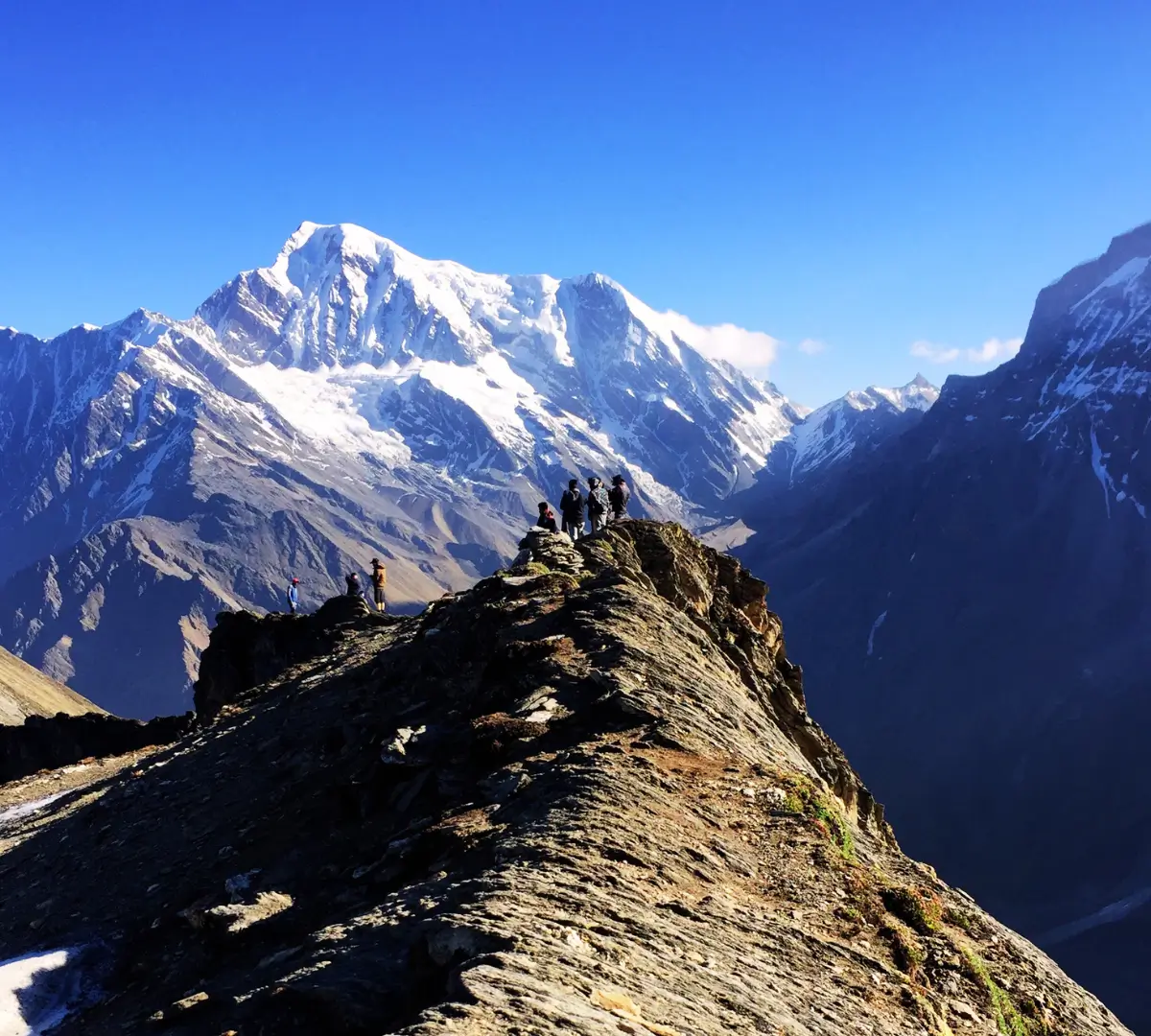
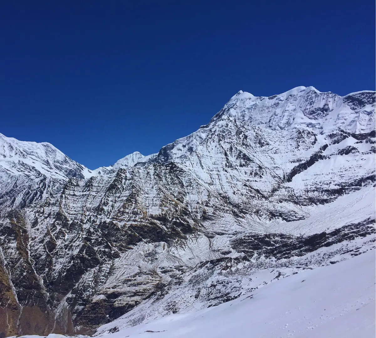
- The trail offers panoramic views of the Garhwal Himalayas, including peaks like Trishul and Nanda Ghunti.
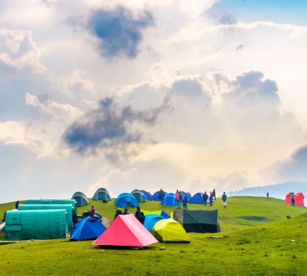
- Ali Bugyal is one of the largest high-altitude meadows, providing a surreal camping experience.
- Overnight stay in tents under the star-lit sky.
Overview
Trek Distance: 5 km (approx. 4 hours)
Starting Altitude: 3,400 meters / 11,154 feet at Ali Bugyal
Ending Altitude: 3,800 meters / 12,467 feet at Ghora Lotani
Detailed Plan
- Continue trekking across the vast meadows, with gentle ascents.
- The trail offers uninterrupted views of the Himalayan ranges and the valley below.
- Arrive at Ghora Lotani, a popular campsite for trekkers.
- Overnight stay in tents.
Overview
Trek Distance: 6 km (approx. 5-6 hours)
Starting Altitude: 3,800 meters / 12,467 feet at Ghora Lotani
Ending Altitude: 4,300 meters / 14,107 feet at Bhagwabasa
Detailed Plan
- Begin with a steep ascent to Kalu Vinayak, marked by a sacred temple.
- The climb is challenging but rewarding, with the temple offering a place for rest and reflection.
- Continue towards Bhagwabasa, traversing rocky terrains and snow patches.
- Overnight stay in tents at Bhagwabasa.
Overview
Trek Distance: 15 km (approx. 8-9 hours)
Starting/Ending Altitude: 4,300 meters / 14,107 feet at Bhagwabasa
Highest Altitude: 5,029 meters / 16,499 feet at Roopkund Lake
Detailed Plan
- Start early in the morning for the final ascent to Roopkund Lake.
- The trail involves steep climbing on rocky and snowy terrain.
- Upon reaching Roopkund Lake, witness the ancient skeletons and stunning views of Mt. Trishul.
- After spending time at the lake, begin the descent back to Bedni Bugyal, passing through Bhagwabasa.
- Overnight stay in tents at Bedni Bugyal, one of the most beautiful meadows of the trek.
Overview
Trek Distance: 12 km (approx. 6-7 hours)
Drive Distance: 15 km (approx. 1 hour from Wan to Lohajung)
Starting Altitude: 3,354 meters / 11,004 feet at Bedni Bugyal
Ending Altitude: 2,320 meters / 7,610 feet at Lohajung
Detailed Plan
- Begin the descent from Bedni Bugyal through dense oak and rhododendron forests.
- Reach Wan Village, from where a vehicle will take you back to Lohajung.
- Enjoy the last night of the trek at Lohajung.
Overview
Drive Distance: 210 km (approx. 10 hours)
Starting Altitude: 2,320 meters / 7,610 feet at Lohajung
Ending Altitude: 554 meters / 1,817 feet at Kathgodam
Detailed Plan
- Drive back to Kathgodam, retracing the scenic route via Almora and Nainital.
- Arrive in Kathgodam by evening, marking the end of the trek.
Important Notes
- Best Time to Visit: The ideal trekking season is from May to June and September to October.
- Difficulty Level: Moderate to Difficult – requires good physical fitness.
- Weather Conditions: Temperatures range from 5°C to 15°C during the day and can drop to -5°C at night.
- Permits: Trekkers need to obtain a permit from the **Forest Department** at Lohajung.
- Acclimatization: Proper acclimatization is crucial as the trek reaches an altitude of over 5,000 meters.
- Network Connectivity: Mobile networks are available in Lohajung but are unreliable beyond that point.
- Eco-Friendly Trek: Follow the Leave No Trace principles – carry your waste back and respect nature.
- Essential Gear: Good trekking shoes, warm layers, rain gear, sunglasses, gloves, trekking poles, and a headlamp.
