Chandranahan Lake Trek – A Mystical Journey to the Sacred Lake
Explore Tours
About the Trek
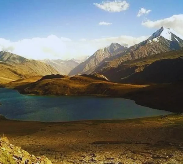
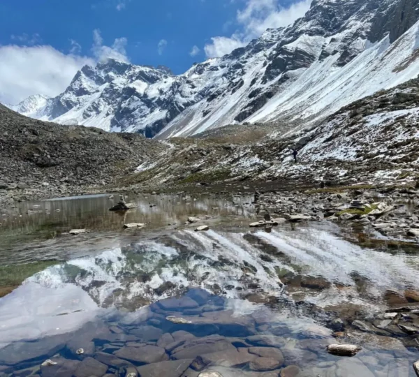
The Chandranahan Lake Trek is a spiritual and scenic trek situated in the Himachal Pradesh region of India. The trek takes you to the beautiful Chandranahan Lake, which is believed to be the source of the Bhagirathi River. The trek takes you through alpine meadows, dense forests, and majestic mountain landscapes. The lake sits at an altitude of 4,150 meters and is known for its tranquil beauty and religious significance.
Key Highlights
- Chandranahan Lake: Trek to the sacred lake, revered by locals and trekkers alike.
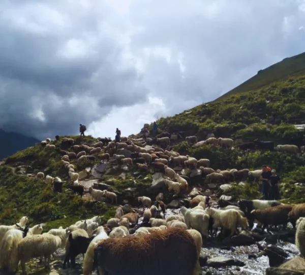
- Pristine Beauty: The route is filled with dense forests, alpine meadows, and crystal-clear streams.
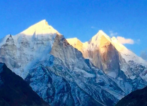
- Panoramic Views: Stunning views of the surrounding peaks, including Mount Kailash and the Bhagirathi massif.
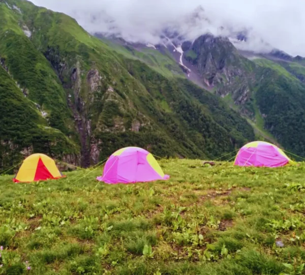
- Peaceful Campsites: Enjoy camping at scenic spots amidst nature.
Tour Description
The trek begins from Sarahan, a village known for its ancient temples. From here, trekkers ascend to the Chandranahan Lake, passing through lush forests and scenic meadows. After reaching the lake, trekkers spend time at the lake before descending back to Sarahan. The trek offers a combination of moderate challenges and breathtaking views of the Himalayas. The lake itself is surrounded by a serene ambiance, making it an ideal spot for spiritual seekers and nature lovers alike.
Challenges
- Altitude Gain: The trek involves considerable altitude gain, so proper acclimatization is necessary.
- Weather Variability: Weather conditions can change abruptly, with occasional snowfall, especially at high altitudes.
- Terrain: The route includes steep ascents and rocky patches that require careful navigation.
Facilities
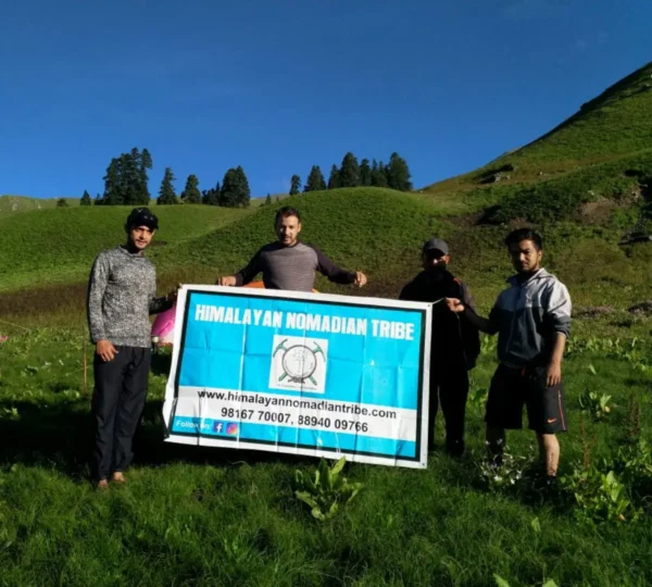
- Experienced Guides: Skilled guides will accompany you throughout the trek.
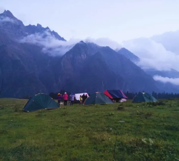
- Accommodation: Tent-based accommodation is provided at the campsites.
- Meals: Nutritious vegetarian meals are served during the trek.
- Safety: The trek includes basic medical facilities and emergency support services.
Who Can Participate?
- This trek is suitable for trekkers with a moderate fitness level.
- Open to individuals aged 18 and above.
- Best suited for trekkers looking for a blend of spirituality and adventure.
How to Reach
- Nearest Railway Station: Kalka Railway Station (approximately 130 km from Sarahan).
- Nearest Airport: Shimla Airport, approximately 160 km from Sarahan.
- Road Connectivity: Sarahan is accessible by road from Shimla, which is well-connected to major cities in North India.
Pick-up and Drop-off Info
Pick-up will be from Shimla Railway Station or Shimla Airport, followed by a drive to Sarahan. Drop-off will be at the same location after completing the trek.
Frequently Asked Questions (FAQ)
- Q: When is the best time to go for the Chandranahan Lake Trek?
A: The best time to trek is from May to October. - Q: Is the trek suitable for beginners?
A: Yes, with a moderate fitness level, beginners can also enjoy this trek. - Q: What type of food is provided during the trek?
A: Vegetarian meals (breakfast, lunch, and dinner) are provided during the trek.
Key Points
- Best Time to Travel: May to October.
- Temperature: Daytime temperatures range from 15°C to 25°C, while nighttime temperatures can drop to 5°C.
- Altitude: 4,150 meters (Chandranahan Lake).
- Longitude: 77.7269°E
- Latitude: 31.4147°N
Included/Exclude
Included in the Tour Package
- Accommodation in tents and local guesthouses.
- Meals (breakfast, lunch, and dinner) during the trek.
- Experienced trek guides, porters, and support staff.
- All necessary permits and entry fees.
- Basic first aid and emergency evacuation services.
Excluded in the Tour Package
- Personal expenses like souvenirs, tips, etc.
- Travel insurance.
- Transportation to and from the base camp (Sarahan).
Tour Amenities
Certified Trek Leader
Hassle-Free Permits
Warm Meals, Always
Itinerary
Overview
Altitude:
- Shimla: 2,276 m / 7,470 ft
- Janglik: 2,800 m / 9,200 ft
Drive Distance: 160 km (approx. 8-9 hours)
Detailed Plan
- Start the drive from Shimla early morning. Travel through picturesque towns like Rohru and Chirgaon, surrounded by dense pine forests and apple orchards.
- The final stretch is a scenic off-road journey to Janglik, the trek’s starting point.
- Spend the evening exploring Janglik, a charming Himalayan village with traditional wooden houses.
- Stay overnight in a guesthouse or tents.
Overview
Altitude:
- Janglik: 2,800 m / 9,200 ft
- Dayara: 3,400 m / 11,150 ft
Trek Distance: 5 km (approx. 4-5 hours)
Detailed Plan
- Begin the trek through dense forests of pine and oak. The trail slowly opens up to lush green meadows.
- Enjoy spectacular views of the snow-capped Dhauladhar range as you ascend.
- Arrive at Dayara, a beautiful campsite with breathtaking valley views.
- Set up camp, have dinner, and rest under the stars.
Overview
Altitude:
- Dayara: 3,400 m / 11,150 ft
- Litham: 3,600 m / 11,800 ft
Trek Distance: 6 km (approx. 4-5 hours)
Detailed Plan
- Start the trek towards Litham, crossing dense forests and alpine meadows.
- Walk along the Pabbar River and admire the majestic Buran Ghati Pass in the distance.
- Reach Litham, a stunning valley with mesmerizing views of waterfalls and glaciers.
- Set up camp and relax with a warm meal.
Overview
Altitude:
- Chandranahan Lake: 4,200 m / 13,800 ft
Trek Distance: 6 km (approx. 5-6 hours round trip)
Detailed Plan
- Start early for the steep climb towards Chandranahan Lake.
- Cross multiple glacial streams and navigate through rocky terrain.
- Arrive at Chandranahan Lake, a sacred high-altitude glacial lake fed by melting snow.
- Spend time soaking in the breathtaking views of the pristine lake and surrounding peaks.
- Return to Litham by afternoon and relax at the campsite.
Overview
Altitude:
- Litham: 3,600 m / 11,800 ft
- Dayara: 3,400 m / 11,150 ft
Trek Distance: 6 km (approx. 4-5 hours)
Detailed Plan
- Start the descent from Litham, retracing the path through green pastures and forests.
- Enjoy the scenic beauty and spot local wildlife along the way.
- Arrive at Dayara and set up camp. Spend the evening relaxing and reflecting on the trek.
Overview
Altitude:
- Dayara: 3,400 m / 11,150 ft
- Janglik: 2,800 m / 9,200 ft
Trek Distance: 5 km (approx. 4-5 hours)
Drive Distance: 160 km (approx. 8-9 hours)
Detailed Plan
- Descend towards Janglik, passing through dense pine and oak forests.
- The trail is easier and takes around 4-5 hours to complete.
- Upon reaching Janglik, board a vehicle for the return journey to Shimla.
- Reach Shimla by late evening, concluding the trek.
Important Notes
- Fitness Level: Moderate; prior trekking experience is beneficial.
- Weather Conditions: Can change rapidly; carry warm clothing.
- Essential Gear: Trekking shoes, rain gear, and personal medications.
- Follow Instructions: Always listen to the trek leader for safety.